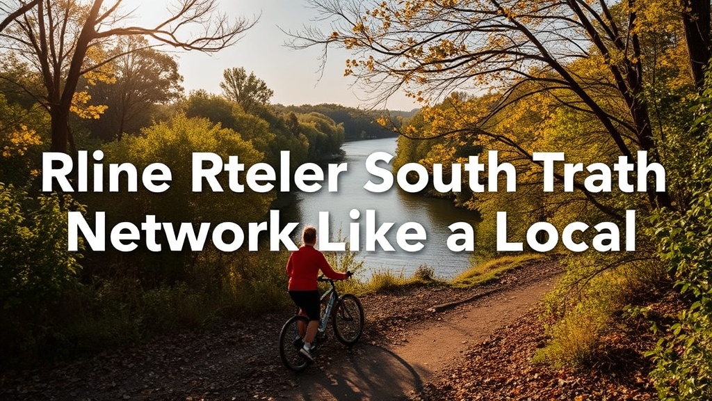
How to Explore the Riverside South Trail Network Like a Local

What This Post Covers (And Why You'll Actually Use It)
This guide maps out the Riverside South trail network from a local's perspective — where to park, which paths connect where, and what most visitors miss entirely. Whether you're new to the area or looking to move beyond the same three loops everyone takes, you'll find practical routes, seasonal timing tips, and gear recommendations that work for Ottawa's unpredictable weather. No fluff. Just what you need to explore the trails without second-guessing every turn.
What's the Best Starting Point for Riverside South Trails?
Earl Armstrong Road and Spratt Road offer the most reliable access points with actual parking lots. The Earl Armstrong entrance — near the intersection with River Road — connects directly to the main paved pathway running parallel to the Rideau River. You'll find about 30 parking spots, a water fountain (seasonal), and clear signage pointing toward the National Capital Commission maintained pathways.
The Spratt Road lot sits closer to the newer development phases. It's smaller — maybe 15 spots — but puts you right at the trailhead for the unpaved sections. Here's the thing: this lot fills by 9 a.m. on summer weekends. Locals know to arrive early or park at the Riverside South Community Centre (3455 Riverside Drive) and walk the extra 400 meters.
A third option exists near the Manotick Hydro Corridor, though parking here is technically residential street parking along River Run Avenue. The city posts restrictions during snow removal season (November through March), so check the signs. The upside? You'll start on the lesser-used eastern trails where dog walkers and trail runners thin out after the first kilometer.
Which Trails Actually Connect — And Which Dead-End?
The main paved pathway runs 4.2 kilometers from Earl Armstrong Road to the southern edge of the development, but the real network extends another 6 kilometers through unpaved multi-use trails and hydro corridor routes. Most first-timers stick to the riverside path. That's fine for an evening stroll. For anything more interesting, you'll want the connecting loops.
The paved spine follows the Rideau River with gentle grades — suitable for strollers, road bikes, and mobility devices. At three points, marked gravel connectors branch west toward the hydro corridor. These aren't always obvious. Look for the brown NCC trail markers (wooden posts with yellow triangles) near the 1.5 km, 2.8 km, and 3.6 km marks.
The western hydro corridor trails form a rough figure-eight pattern. The northern loop measures 2.3 km; the southern loop adds another 1.8 km. These sections drain poorly after rain — expect mud for 24 to 48 hours following any significant precipitation. In winter, they're not maintained. Snowshoes or traction devices become necessary.
Worth noting: there's no direct riverside connection between the Earl Armstrong and Spratt Road sections without backtracking or cutting through residential streets. The gap spans roughly 800 meters. Some runners use River Road's shoulder (not recommended — the speed limit is 80 km/h and visibility curves are poor). Most locals either accept the out-and-back format or loop through the hydro corridor to create a full circuit.
Trail Surface Comparison
| Trail Section | Surface | Best For | Seasonal Notes |
|---|---|---|---|
| Main Riverside Path | Asphalt | Strollers, wheelchairs, road bikes | Cleared winter; busiest May–September |
| Hydro Corridor North | Compacted gravel | Trail running, mountain bikes | Muddy after rain; snow-packed in winter |
| Hydro Corridor South | Natural surface | Hiking, dog walking | Overgrown July–August; best in spring/fall |
| Connector Paths | Mixed gravel/dirt | All users (conditions dependent) | Temporarily closed during spring thaw |
What Gear Do You Actually Need for Riverside South Trails?
For the paved sections, normal athletic shoes suffice year-round; the hydro corridor trails demand trail running shoes or light hiking boots depending on conditions. The difference matters. After a rainfall, the unpaved sections hold water in low spots that won't dry for days. Road-running shoes with minimal tread — think Nike Pegasus or Brooks Ghost models — slip on the compacted gravel and soak through immediately in muddy sections.
Trail runners with aggressive lug patterns (the Salomon Speedcross line, for example) handle the hydro corridor well. For winter, consider Yaktrax or similar traction devices from December through February. The paved path gets occasional maintenance, but ice patches persist in shaded sections near the river.
Bugs define the experience from late May through mid-July. Black flies peak in late May; mosquitoes take over in June. A headnet sounds excessive until you've tried running while swatting. Permethrin-treated clothing helps significantly. The catch? You'll want to treat gear 24 hours before wearing it — not something to remember halfway through a run.
Cycling the main path works on any bike. The gravel connectors require at minimum 32mm tires with some tread. Road bikes with 23mm or 25mm tires should skip the hydro corridor entirely — the loose stone chews through rubber and risks pinch flats.
When's the Best Time to Hit the Trails?
Weekday mornings (6 to 8 a.m.) and weekday evenings after 7 p.m. offer the most solitude; weekend mornings before 8 a.m. beat the family and dog-walker rush. The trails follow predictable patterns. Saturday and Sunday between 9 a.m. and 11 a.m. — packed. Parents with strollers, dogs on extendable leashes, and groups walking three abreast. Not hostile territory, but you'll break rhythm constantly if you're running or cycling.
Sunset runs in winter (4:30 to 5:30 p.m.) hit a sweet spot. The commuter crowd hasn't arrived, and the path lighting — installed in 2022 along the main route — actually works well. The unpaved sections stay dark, so bring a headlamp if you're venturing off-pavement.
Seasonal flooding affects the low-lying sections near the 3-kilometer mark every spring — usually mid-April through early May depending on snowmelt upstream. The city posts temporary closure signs, but they appear late. If the path looks submerged, it probably is. The water carries agricultural runoff from upstream farms — not something to wade through.
Fall colours peak in Riverside South about two weeks after the Algonquin Park reports start trending. Early October typically delivers the best riverbank views. The hydro corridor — mostly meadow and scrub — doesn't offer much autumn spectacle, but the riverside section through deciduous forest justifies the trip alone.
What Wildlife Should You Expect?
White-tailed deer, wild turkeys, red foxes, and over 120 bird species have documented sightings along these trails. The deer are habituated — they'll stare from ten meters away, unbothered, then continue grazing. Turkeys move in flocks of eight to fifteen and scatter dramatically if startled. Worth noting for cyclists: a startled turkey runs before it flies, usually in the direction it was already facing. Predictable once you know the pattern.
Coyotes inhabit the hydro corridor but avoid human contact during daylight. Dawn and dusk encounters happen — give them space, keep dogs leashed, and don't attempt photography that puts you off-path. The eastern screech owls in the riverside forest section are harder to spot but audible on winter evenings.
Poison ivy grows in three distinct patches near the hydro corridor — marked with small wooden signs that disappear under vegetation by July. Learn to identify the "leaves of three" pattern. The trails don't see enough foot traffic to keep paths cleared through these sections, so staying alert matters more than you'd expect for an urban-adjacent network.
Where Do Locals Go After the Trail?
Post-run or post-ride, the practical options cluster around Spratt Road and Earl Armstrong. The Bridgehead Coffee location at 4255 Strandherd Drive — about four minutes by car from the Earl Armstrong trailhead — opens at 6 a.m. and serves actual food beyond pastries. The Main Street Bagel outpost in the same plaza does breakfast sandwiches that survive the drive home.
For a longer stop, Dick's Drive-In on River Road (technically Manotick) operates seasonally from March through October. It's a 15-minute walk or 3-minute drive from the Spratt Road trailhead. The fish and chips draw crowds from across Ottawa's south end — expect a 20-minute wait during summer evenings.
That said, many locals skip the commercial options entirely. The parking lots at both trailheads include basic amenities — water fountains, bike repair stations (basic tools on a tether), and benches. Pack a thermos, sit on the riverbank, and watch the herons work the shallows. Sometimes the best post-trail activity is no activity at all.
The Riverside South trail network won't make provincial tourism brochures. It's not rugged wilderness or dramatic scenery. What it offers is accessibility — genuine, practical, five-minutes-from-your-door accessibility — combined with enough variety to keep regulars engaged through multiple seasons. Start with the paved path. Branch into the hydro corridor when you're ready. Learn the mud patterns, the bug cycles, the parking rhythms. That's how locals do it. That's how you'll do it too.
Steps
- 1
Choose the Right Trail for Your Skill Level
- 2
Prepare Essential Gear and Check the Weather
- 3
Navigate Key Trailheads and Parking Areas